

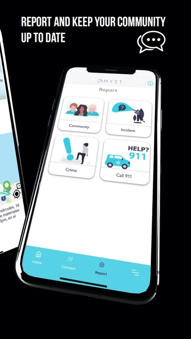

MYST, Inc. (“MYST”) is a civilian awareness and incident reporting platform with the ability to instantly communicate important hazard situations and incidents within the community. Its purpose is to enhance the communication within citizens as it seeks to streamline the response during an emergency or to prevent one. It functions as a Reporting tool, which combines GIS-enable technology and a user-friendly data collection system. You can report community incidents, important hazards awareness, and possible criminal activity. You will receive real-time notification from your neighbors and peers of the things you might need to know. You can also save your information from your property so it is always available when you need it, it can be utilized for insurance claims purposes as well.
It generates a “Case” for hazards within the user’s private property and around their community. The case will provide information entered by the user, GIS mapping localization, Descriptions, Type of Emergency or Incident, the possible Cause, Danger classification, Type of ownership, and Pictures from each damage reported, pictures and videos. It’s also has a comments section for other user to engage in the conversation to provide insight or updates regarding a certain case reported. The user will also be able to see in a live GIS map all the reports from other users in the community, including pictures within their community.
It will have two different GIS-enable maps segregated into three categories “Community Cases”, “Incident Case”, and “Possible Criminal Activity”.
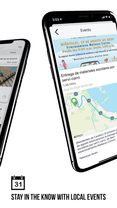
Also, the user will have the opportunity to view important events happening in their communities.
Features:
- Connects users within same community.
- Save important information from your property like pictures, documents and insurance information.
- Know about events happening in or near your community.
- Classify emergencies by type, cause, and places.
- Pictures.
- GIS-enabled Address Identification.
- Mapping and GPS Navigating.
- User-friendly Damage Reporting System.